Short hiking trails near Stockholm: family-friendly loops under 5 km
In Tyresta National Park, 20 km from the city centre, short marked trails range from the 650-metre Allemansråttans stig to the 5 km Bylsjöpromenaden, and the first stage of Sörmlandsleden starts at Björkhagen metro station.
Short marked trails you can reach by SL public transport.
Tyresta National Park: Urskogsstigen, Bylsjöpromenaden and more
Tyresta National Park lies 20 km from central Stockholm, and several short marked trails start from Tyresta by (Tyresta village). Sweden's National Parks gives the length and marking for each trail:
Allemansråttans stig
650 m
Along the path you get tasks and tips on things to discover.
Tjäderstigen
1.3 km
Collect letters for a secret password and earn a certificate.
Urskogsstigen
green marking with six dots2 km
Signs along the trail teach you more about Tyresta's old-growth forest.
Hällmarksstigen
red/white marking2.5 km
An alternative route between Tyresta by and Bylsjön.
Bylsjöpromenaden
red marking with one dot5 km
An easy walk that takes you around the lake Bylsjön.
Nacka
Nackareservatet: from Björkhagen and Hellasgården
- Metro to Björkhagen
- Bus 401 to Hellasgården
- Sörmlandsleden stage 1
The first stage of Sörmlandsleden starts at Björkhagen metro station and heads east into the Nacka outdoor recreation area – according to Sörmlandsleden, it is about 2 kilometres to the lake Söderbysjön. At Hellasgården, reached by bus 401 from Slussen, there are trails for running, hiking, trail running and mountain biking that you can download from Hellasgården's website.
Vallentuna
Angarnssjöängen: boardwalks and birdwatching
- Roslagsbanan
- Bus towards Kårsta
- Just under 7 km
- Sjöängsslingan
- The County Administrative Board gives a trail of just under seven kilometres around Angarnssjöängen in Vallentuna.
- Accessibility
- Accessible parking spaces with connecting trails are only available at Örsta, and a surfaced path leads to the Byksberget viewpoint, which has a wheelchair ramp. The landscape: the County Administrative Board calls the lake one of Stockholm's finest bird lakes and highlights grazed shore meadows and flowering pastures. Most birdwatchers head for Midsommarberget, on the right as you walk down towards the meadows from Örsta, and further east there is a bird tower. At Örsta the car park is often full at weekends – visitors are then directed to Olhamra, Kusta and Skesta.
- By public transport
- The Roslagsbanan train to Vallentuna, then a bus towards Kårsta – get off at Örsta, 200 metres from the reserve.
- Camping
- Only within the designated area, and for no more than two nights in a row.
Classic day hikes from Stockholm by public transport
The six southernmost stages of Sörmlandsleden are 6.5–13 km long, and the first starts at Björkhagen metro station. Stages 5–11 of Roslagsleden are 8.7–23.8 km.
Sörmlandsleden and Roslagsleden are divided into stages with a published start, finish and length. Here are the ones you can reach from Stockholm.
Sörmlandsleden on Södertörn: from the suburbs to old-growth forest
Sörmlandsleden is marked in orange with an S and is made up of more than 90 stages. You can reach the six southernmost from Stockholm:
6 stages · 61.5 km in total
- 01
BjörkhagenSkogshyddan
8.5 km
Starts at Björkhagen metro station.
- 02
SkogshyddanAlby friluftsgård
6.5 km
Bus 801 runs to Skogshyddan from Gullmarsplan towards Älta/Lovisedal, stop Bäckalidsvägen.
- 03
Alby friluftsgårdTyresta by
13 km
A spring after 6 km, and a wind shelter with an outdoor toilet at Årsjön after 8 km.
- 04
Tyresta byHanden (Rudans gård)
10 km
- 05
Handen (Rudans gård)Paradiset
11.5 km
Wind shelters after about 9.5 and 10.5 km, and at Paradiset.
- 06
From Paradiset
12 km
A wind shelter and water pump at the start, and a wind shelter and spring after 7 km. SL bus 709 runs from Huddinge station to the stops Bruket or Ådran.
Roslagsleden north of the city: cultural landscapes and forest paths
Destination Roslagen publishes stages 5–11 with route and length:
7 stages · 122.2 km in total
- 05
DomaruddenWira bruk
20.3 km
Through lake-studded forest and the Trehörningsskogen nature reserve, past the lakes Oppsjön, Holmsjön and Viren.
- 06
Wira brukPenningby
19.9 km
One of the longest stages on the trail, ending at medieval Penningby Castle.
- 07
PenningbyVigelsjö
15.9 km
Past Länna Church and the hillfort by Kyrksjön, and along the waterfront promenade through Norrtälje harbour.
- 08
VigelsjöRoslagsbro
12.6 km
Through two nature reserves and past Färsna 4-H farm.
- 09
RoslagsbroGåsvik
23.8 km
Along old church paths and via Flottskär to the Bagghusbron bridge on the Väddö Canal.
- 10
GåsvikSandviken
8.7 km
Along the Väddö Canal, past the Roslagen Maritime Museum and the Storängen nature reserve.
- 11
SandvikenGrisslehamn
21 km
Along the Väddö coast to the old fishing harbour at Grisslehamn.
Full-day hiking near Stockholm: the national park and large nature reserves
Tyresta's longer trails are 6–16 km – the 13 km Tyrestarundan works as a day hike and the 16 km Sjöleden can be split over two days – and bus 834 runs to the main entrance at Tyresta by.
For a full day, there are longer trails in Tyresta and several nature reserves around Stockholm. Here is what the managers themselves publish.
Tyresta National Park: longer marked loops
Longer marked trails in Tyresta, with length and marking according to Sweden's National Parks:
Fornborgsrundan
black marking with eight dots6 km
A demanding hike through hilly terrain with several steep sections.
Styvnäsrundan
yellow marking with two dots6 km
Passes an 18th-century båtmanstorp, the croft of a navy seaman, among other sights.
Kustleden
orange marking with three dots7 km
Through the cultural landscape from the Åvaviken entrance to Mörkdalen.
Storskogsrundan
white marking with seven dots8 km
A varied hike over different kinds of ground.
Pilgrimsleden
11.5 km
There are several meditation spots along the trail.
Tyrestarundan
purple marking with four dots13 km
Works well as a day hike.
Sjöleden
blue marking with five dots16 km
A hike you can do over one or two days.
By public transport: Bus 834 to the main entrance, stop Tyresta by. Bus 807 or 809 to the stop Svartbäcken, then about 3 kilometres to the entrance.
Huddinge
Paradiset nature reserve: rest cabin, wind shelter and Sörmlandsleden
- Rest cabin
- Wind shelter at Trehörningen
- Sörmlandsleden stages 5–6
- Bus 709
Paradiset in Huddinge is a municipal nature reserve where several hiking trails start from the old croft of Paradiset. Facilities: There is a rest cabin at the croft and a wind shelter by the lake Trehörningen. The reserve also has several Stone Age settlement sites. Link to Sörmlandsleden: Stage 5 ends at Paradiset and stage 6 starts here, with a wind shelter and water pump at the start of the stage. By public transport: An SL bus runs from Huddinge station to the stop Bruket; Sörmlandsleden gives bus 709 to Bruket or Ådran. The neighbouring reserve, Tornberget: Paradiset borders Tornberget nature reserve in Haninge, where Tornberget, 111 metres above sea level, is the highest point in Stockholm County. A 10-metre viewing tower stands on the top – you can't get there with a pushchair. Haninge Municipality gives bus 848 from Västerhaninge to Västra skolan, then about 2 km along road 257 to the turn-off for Slåboda.
South of Stockholm
Gålö nature reserve: coastal trails and an ancient monument trail
- Fornstigen
- Grazing land and shore meadows
- Bus from Västerhaninge
Gålö, south of Stockholm, is managed by the Archipelago Foundation and has hiking trails that wind through grazing land, shore meadows, forests and seaside landscapes. Fornstigen: Along this cultural-heritage trail, information signs tell you about the area's history and natural values. By public transport: A bus runs to the area from Västerhaninge – look up the current route and stop in SL's journey planner.
Vaxholm Municipality
Bogesundslandet: forests, swimming spots and wind shelters
- Wind shelters
- Fireplaces
- Swimming spots
- Location
- A peninsula in Vaxholm Municipality, surrounded by the bays Stora Värtan, Askrikefjärden and Vaxholmsfjärden.
- In the reserve
- Forests for mushroom and berry picking, bridle paths, swimming spots, hiking trails, picnic areas, fireplaces and wind shelters. Managed by the National Property Board Sweden.
- Rules
- You may not camp for more than two nights in a row except at designated sites, cycle off-road except on designated bike paths, or ride except on roads and designated bridle paths.
Camping on hiking trails near Stockholm: wind shelters and tent rules
The Right of Public Access allows camping for a night or so, but nature reserves have their own rules: in Tyresta at most one night at the same rest area, at Angarnssjöängen and on Bogesundslandet at most two nights. Tyresta has wind shelters at Årsjön, Långsjön and Lanan, among other places.
Along several trails there are wind shelters and places where camping is allowed – but the rules differ from one area to the next.
Camping rules: the Right of Public Access, nature reserves and Tyresta
Right of Public Access
A night or two
Tyresta, at a fire site
At most one night in the same spot
Angarnssjöängen
At most two nights, within the designated area
Bogesundslandet
At most two nights in a row outside designated sites
Tyresta by, camping meadow
Three nights
- The Right of Public Access (allemansrätten): You may pitch a tent in nature for a night or two, as long as you don't disturb anyone or cause damage.
- Nature reserves
- The rules vary – at Angarnssjöängen only within the designated area for at most two nights, at Bogesundslandet at most two nights in a row except at designated sites. Read the regulations for each reserve.
- Tyresta National Park
- Camping is allowed next to designated fire sites, fireplaces and wind shelters, for at most one night in the same spot. On the camping meadow at Tyresta by, with toilets and an outdoor sink, you may camp for three nights.
The best wind shelters and campsites close to the city
Tyresta
- Årsjön · Långsjön · Lanan
Wind shelters at Årsjön, Långsjön and Lanan, according to Sweden's National Parks. Expect to share a shelter with others.
Paradiset (Huddinge)
- Wind shelter and rest cabin
A wind shelter by the lake Trehörningen and a rest cabin at the croft of Paradiset. Sörmlandsleden stage 6 starts here, with a wind shelter and water pump at the start of the stage.
Sörmlandsleden stages 3 and 5
- Stage 3 · stage 5
A wind shelter with an outdoor toilet at Årsjön on stage 3, and wind shelters after about 9.5 and 10.5 km on stage 5.
Campfires in forests and fields: firewood, safety and fire bans
Only light fires at designated sites: In Tyresta you may only light a fire at prepared picnic sites, and the park charges for firewood. Many nature reserves have similar regulations.
Fire bans: Always check whether the municipality or the County Administrative Board has issued a fire ban before you light a fire.
Autumn and winter hiking near Stockholm
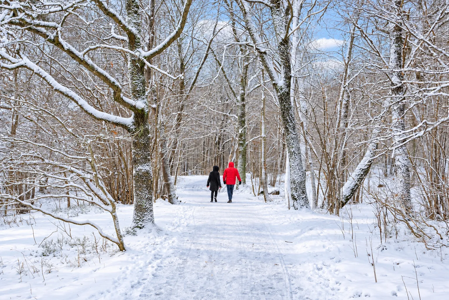
After a winter day in the Nacka nature reserve, Hellasgården has a sauna and an ice hole, open 09:00–21:00 in the lighter part of the year and 09:00–18:00 in the darker part.
In autumn and winter the days are short and the ground is often slippery. Plan accordingly.
Nackareservatet
Floodlit trail at Hellasgården
- Floodlit trail
- Check lighting times
At Hellasgården in Nackareservatet, the outdoor gym is at the start of the floodlit trail. Check lighting times and trail lengths on site.
Winter trail safety: slippery boardwalks, bare rock and ice cleats
Boardwalks and bare rock
Get slippery with leaves, frost and ice – tread carefully.
Ice cleats
Worth bringing when the trail may be icy.
Head torch
Bring a charged head torch – it gets dark early.
A warm finish: sauna and ice hole at Hellasgården
After a winter day in Nackareservatet, you can finish at Hellasgården by the lake Källtorpssjön, with a sauna and an ice hole kept open by a pump. Hellasgården gives opening hours of 09:00–21:00 in the lighter part of the year and 09:00–18:00 in the darker part, and holds Aufguss aroma sauna sessions on Wednesday evenings. Bus 401 runs from Slussen to the Hellasgården stop.
- Lighter part of the year: 09:00–21:00
- Darker part of the year: 09:00–18:00
Getting there and packing list for hiking trails near Stockholm
With public transport you can start at one stop and finish at another – for example the 10 km stage 4 of Sörmlandsleden, from Tyresta by to the commuter train station in Handen.
Most of the trails on this page can be reached by SL public transport.
Getting to the trail with SL: bus, metro and commuter train
Plan the journey: Search SL's journey planner for stops such as Tyresta by, Hellasgården or Björkhagen.
Point-to-point hikes: With public transport you can start at one stop and finish at another – for example Sörmlandsleden stage 4 from Tyresta by to the commuter train station in Handen.
Packing list for a good day hike
- Water
- Packed lunch
- Layers
- Rain gear
- Sit pad
- Head torch
- Map
- Charged phone
Water, a packed lunch, layers, rain gear, a sit pad, a head torch, a map and a charged phone. If you light a fire in Tyresta: expect to pay for the firewood.
Navigation: maps, offline GPS and trail markings
Sörmlandsleden: Marked in orange with an S.
Tyresta: Each trail has its own colour and number of dots, according to Sweden's National Parks.
Map: Download maps or tracks in advance – for example Hellasgården's trails or the trail map from Sweden's National Parks.
Frequently asked questions
3 questions
01Can you camp anywhere along the hiking trails near Stockholm?
The general rule under the Right of Public Access (allemansrätten) is that you may camp in nature for a night or two, as long as you don't disturb the landowner or damage the environment. There are, however, important local exceptions:
- Nature reserves
- Angarnssjöängen only allows camping within the designated area and for at most two nights in a row. Bogesundslandet has the same rule: no more than two nights in a row except at a designated site.
- Wind shelters along Sörmlandsleden: The Sörmlandsleden association lists wind shelters stage by stage, including at Årsjön (with an outdoor toilet) on stage 3 and at Paradiset on stages 5 and 6.
- Always check
- Read the information board at the trailhead or the reserve's regulations for the exact local rules before you pitch your tent.
02What are some good easy hikes near Stockholm for beginners and dogs on a lead?
Two trails that are clearly marked and easy going, according to the managers' own descriptions:
- Bylsjöpromenaden (Tyresta National Park, 5 km, red marking with one dot): Sweden's National Parks describes it as an easy walk, and it takes you around the lake Bylsjön.
- Sjöängsslingan (Angarnssjöängen, just under 7 km): Circles the lake meadow, and is reached by the Roslagsbanan train to Vallentuna plus a bus towards Kårsta.
Dogs: The Swedish Environmental Protection Agency states that dogs must always be kept on a lead in national parks and nature reserves, and on a lead in nature from 1 March to 20 August, when wild animals have young. In some protected areas dogs may not be allowed at all – check before you go.
03Does it cost anything to hike the trails?
Hiking the trails is free, but expect some fees around them – for example parking at Tyresta by and firewood at Tyresta's fire sites.
Sources
Details checked against these sources in September 2026.
The facts on this page are based on these sources. Under each one you can see which details we took from it. Opening times, prices and departures change – always check with the source before you go.
- Sweden's National Parks: Tyresta National Park – activities · in Swedishlength and marking for every trail: Allemansråttans stig 650 m, Tjäderstigen 1.3 km, Urskogsstigen 2 km, Hällmarksstigen 2.5 km, Bylsjöpromenaden 5 km, Fornborgsrundan 6 km, Styvnäsrundan 6 km, Kustleden 7 km, Storskogsrundan 8 km, Pilgrimsleden 11.5 km, Tyrestarundan 13 km, Sjöleden 16 km
- Sweden's National Parks: Tyresta National Park – things to dooverview of the trails, from walks under an hour to full-day routes
- Sweden's National Parks: Tyresta National Park – getting herebus 834 all the way to Tyresta by; bus 807/809 to Svartbäcken plus an approx. 3 km walk
- Sörmlandsleden: stage 1 Björkhagen–Skogshyddan 8.5 km · in Swedish
- Sörmlandsleden: stage 2 Skogshyddan–Alby friluftsgård 6.5 km · in Swedishbus 801 from Gullmarsplan towards Älta/Lovisedal, stop Bäckalidsvägen
- Sörmlandsleden: stage 3 Alby friluftsgård–Tyresta by 13 km · in Swedishspring after 6 km, wind shelter with outdoor toilet at Årsjön after 8 km
- Sörmlandsleden: stage 4 Tyresta by–Handen (Rudans gård) 10 km · in Swedish
- Sörmlandsleden: stage 5 Handen · in SwedishRudans gård)–Paradiset 11.5 km (wind shelters after approx. 9.5 and 10.5 km and at Paradiset
- Sörmlandsleden: stage 6, 12 km · in Swedishwind shelter and pump at the start, wind shelter and spring after 7 km; SL bus 709 from Huddinge station to Bruket or Ådran
- Sörmlandsleden: plan your hike · in Swedishthe trail is made up of more than 90 stages, marked in orange with an S
- Destination Roslagen: Roslagsleden stages 5–11routes, lengths and what you pass: stage 5 Domarudden–Wira bruk 20.3 km, stage 6 Wira bruk–Penningby 19.9 km, stage 7 Penningby–Vigelsjö 15.9 km, stage 8 Vigelsjö–Roslagsbro 12.6 km, stage 9 Roslagsbro–Gåsvik 23.8 km, stage 10 Gåsvik–Sandviken 8.7 km
- County Administrative Board of Stockholm: Angarnssjöängen nature reserve · in Swedishone of Stockholm's finest bird lakes; flowering pastures; Midsommarberget and a bird tower; Byksberget viewpoint with wheelchair ramp; overflow parking at Olhamra, Kusta and Skesta; Sjöängsslingan just under seven kilometres; Roslagsbanan to Vallentuna and bus towards Kårsta, get off at Örsta 200 metres from the reserve; camping only within the designated area and for at most two nights in a row
- County Administrative Board of Stockholm: Paradiset nature reserve · in Swedishmunicipal reserve, rest cabin at the Paradiset croft, wind shelter at Trehörningen, Stone Age settlement sites; SL bus from Huddinge station to the stop Bruket
- County Administrative Board of Stockholm: Bogesundslandet nature reserve · in Swedishpeninsula in Vaxholm Municipality, hiking trails, picnic areas, fireplaces and wind shelters; managed by the National Property Board Sweden; camping at most two nights in a row except at designated sites
- The Archipelago Foundation: Gålö · in Swedishhiking trails through grazing land, shore meadows and seaside landscapes; cultural-heritage trail with information signs; bus from Västerhaninge
- Swedish Environmental Protection Agency: Dogs in nature · in Swedishdogs must always be on a lead in national parks and nature reserves; lead required 1 March–20 August; dogs may be banned in some protected areas
- Hellasgården: opening hours for reception, sauna, gym and café · in Swedish9–21 or 9–18 depending on the season; Aufguss aroma sauna on Wednesday evenings
- Sweden's National Parks: Tyresta – staying overnight in the park · in Swedishtents by fire sites, fireplaces and wind shelters for at most one night; three nights on the camping meadow at Tyresta by; wind shelters at Årsjön, Långsjön and Lanan
- Hellasgården: Trails and outdoor gym · in Swedishtrails for running, hiking, trail running, MTB and swimrun; outdoor gym at the start of the floodlit trail
- Haninge Municipality: Tornberget nature reserve · in Swedish111 m above sea level, the highest point in Stockholm County; borders Paradiset; bus 848 from Västerhaninge to Västra skolan, approx. 2 km along road 257 to Slåboda
- Haninge Municipality: The viewing tower on Tornberget · in Swedish10-metre tower, completed 2018; not accessible with a pushchair